
Find People Along a La Mesa Street
A street directory search works best as a five-part walk. Start with the exact address, confirm that it falls in La Mesa rather than a nearby postal area, and use the county roll to obtain the APN. The parcel map then shows the lots that touch the street. Assessor staff or a kiosk can provide lawful ownership and mailing detail, while the Recorder’s index supplies recorded parties and dates. Historical reverse directories add named householders, phones, and street order for earlier years.
- Check the street address in the San Diego County secured assessment search and record the APN, value context, and situs spelling.
- Open SanGIS or the county parcel map, compare the subject lot with adjoining APNs, and confirm jurisdiction.
- Use the assessor’s Public Information channel or an ARCC kiosk for ownership, mailing, sales, and map detail that the web roll withholds.
- Search the Recorder’s grantor and grantee index, then order or view the instrument when a deed role matters.
- Finish with a reverse directory at the La Mesa History Center or San Diego Public Library when the question reaches an earlier household.
The result is an evidence trail, not a promise that every person on the street appears in one directory.
Resolve a La Mesa Address
The secured assessment roll is the cleanest first stop for a current La Mesa street address. Its “Search Secured Assessment Roll by” menu offers Parcel Number, Address, and Street Name. Address searches use the number and street name, with direction, street type, and city omitted. Street Name is described for parcels without numbers, so it should not be treated as a complete browse mode for every numbered parcel.
Parcel Number is a conditional field. The research capture shows a full form such as 123-456-78-90 and a minimum of 123-456-78. Search and Clear are the visible buttons. Results can return assessed land and improvement values, base-year context, and property characteristics. California Government Code § 7928.205 prevents the assessor from displaying the owner name on the public Internet.
| Field or control | Type | Required | Format or use |
|---|---|---|---|
| Search Secured Assessment Roll by | Dropdown | Yes | Parcel Number, Address, or Street Name |
| Parcel Number | Text | Conditional | Eight-digit minimum pattern; full APN uses dashes |
| Address | Text | Conditional | Number plus street name; omit direction, type, and city |
| Street Name | Text | Conditional | For parcels without numbers, not a full street roster |
| Search / Clear | Buttons | Action | Run the query or remove the fields |
The San Diego secured assessment search is the source for those field rules. The APN is the bridge to maps and deeds, not a resident list.
Separate La Mesa Street Identifiers
Three labels can describe one property, and each belongs to a different record task. The situs address is the physical parcel location. A mailing address is where a bill or deed notice is sent. The legal description uses metes and bounds or a recorded map reference to identify the land. An entity, trust, agent, or absentee owner can make the mailing line differ from the house itself.
That distinction matters on a La Mesa street because ZIP geography and city geography do not match. The city says most 91941 locations and in-city 91942 locations should be checked against its Street Address Listing. An address with a La Mesa postal line can fall outside the incorporation line, while an older record can use a former street name. Confirm the municipal custodian before asking about permits or code files.
- APN
- The assessor parcel number used to join the roll, map, and property record requests.
- Situs
- The physical site address, distinct from the place where mail is sent.
- Legal description
- The metes-and-bounds or recorded-map language that identifies land in an instrument.
- Plat or recorded map
- A filed map that shows lots, streets, dimensions, and adjoining parcels; it is an assessment aid, not a survey.
Keep all three identifiers in notes. A deed search can fail when an old number is used without its APN or legal description.
Browse La Mesa Parcels Along a Street
SanGIS and the San Diego County mapping layers add the block view that a single address search lacks. County maps show APNs, dimensions, acreage where applicable, street widths, lot boundaries, adjoining parcels, and recorded-map references. They do not show owners or addresses. Read the surrounding APNs, then request the matching ownership or mailing information through the assessor’s phone channel or an ARCC kiosk.
The county mapping inventory reports more than 33,776 maps covering roughly 1,087,225 parcels. Those numbers describe the map system, not the count of people on a La Mesa street. Map copies have a $13 first oversize page charge and $0.50 for each additional page, with $1 certification. Assessment maps help orient a search, but they do not decide title, easement, or use questions.
SanGIS’s mapping gateway and the SanGIS/SANDAG open-data catalog supply parcel and boundary layers. The city GIS hub is also available at La Mesa Interactive Maps, though its dynamic popup fields and radius tools were not verified.
La Mesa Records Searchable by Street
The address side of a La Mesa street directory is a set of linked record types. Each row answers a different question, and several require a counter, phone call, library visit, or focused request rather than a single web form.
| Record set | Keeper | Street-level clue | Access |
|---|---|---|---|
| Secured roll | County Assessor | APN, assessed value, property characteristics | Free web search; owner detail by phone or kiosk |
| Parcel map | ARCC Mapping / SanGIS | Adjacent APNs, lot lines, streets, map references | Open layers or map request; no names |
| Recorded instruments | ARCC Recorder | Deed chain, liens, grantor and grantee roles | 1970-present web index; older kiosk and archives |
| Permits and code files | La Mesa Community Development | Applicant, owner or agent as filed; work dates | MaintStar, counter, or CPRA request |
| Reverse directories | History Center / SDPL | Address sequence, householder, phone, older businesses | Onsite, microfilm, or digitized run |
The APN ties the roll and deed records together. The street name ties the parcel to a reader’s mental map. Neither key produces a full list of household members.
La Mesa Deeds After APN Shift
AB 1785 changed the order of operations. Since December 9, 2024, APN queries were removed from official-record web indexes. Grantor and grantee searching remains online, but APN searching is available at five ARCC public kiosks. Images also remain a kiosk or paper-copy matter. A current La Mesa street search therefore starts with the online address roll, but may need an in-person bridge before the deed appears.
At a kiosk, use the APN, older indexes, and images when a street text search is too broad. Online, search both roles because a person can appear as grantee in one instrument and grantor in the next. Capture the recording date, document number, and type before ordering a copy. A deed role confirms a recorded connection to land, not day-to-day residence.
Counter versus web. The 1970-present grantor and grantee index is a free online finding aid. APN search, older index routes, and document images require an ARCC kiosk or an ordered paper copy.
That online-versus-physical split is the defining quirk of the current street directory trail. A failed APN query is not a failed parcel record.
Read La Mesa Permits by Address
Building and code records can date physical change along a street. La Mesa’s Building Division handles plan review, permit processing, and code-compliance inspection. The MaintStar portal supports applications, plans, invoices, and inspection scheduling after account creation, and the city says permit status can be checked online. The public capture did not establish a searchable historical address screen, coverage start, result limit, or sample permit, so a blank portal result should not be treated as proof that a file is absent.
Use the Building counter or a focused NextRequest request when an address and date window matter. Right-of-way records can add dates for sidewalk, curb and gutter, ramps, streetlights, trenching, water service, sewer laterals, and related work. They describe a site and a filed applicant, owner, or agent. They do not name every person who used the address.
The La Mesa permit and inspection portal is the online starting point.
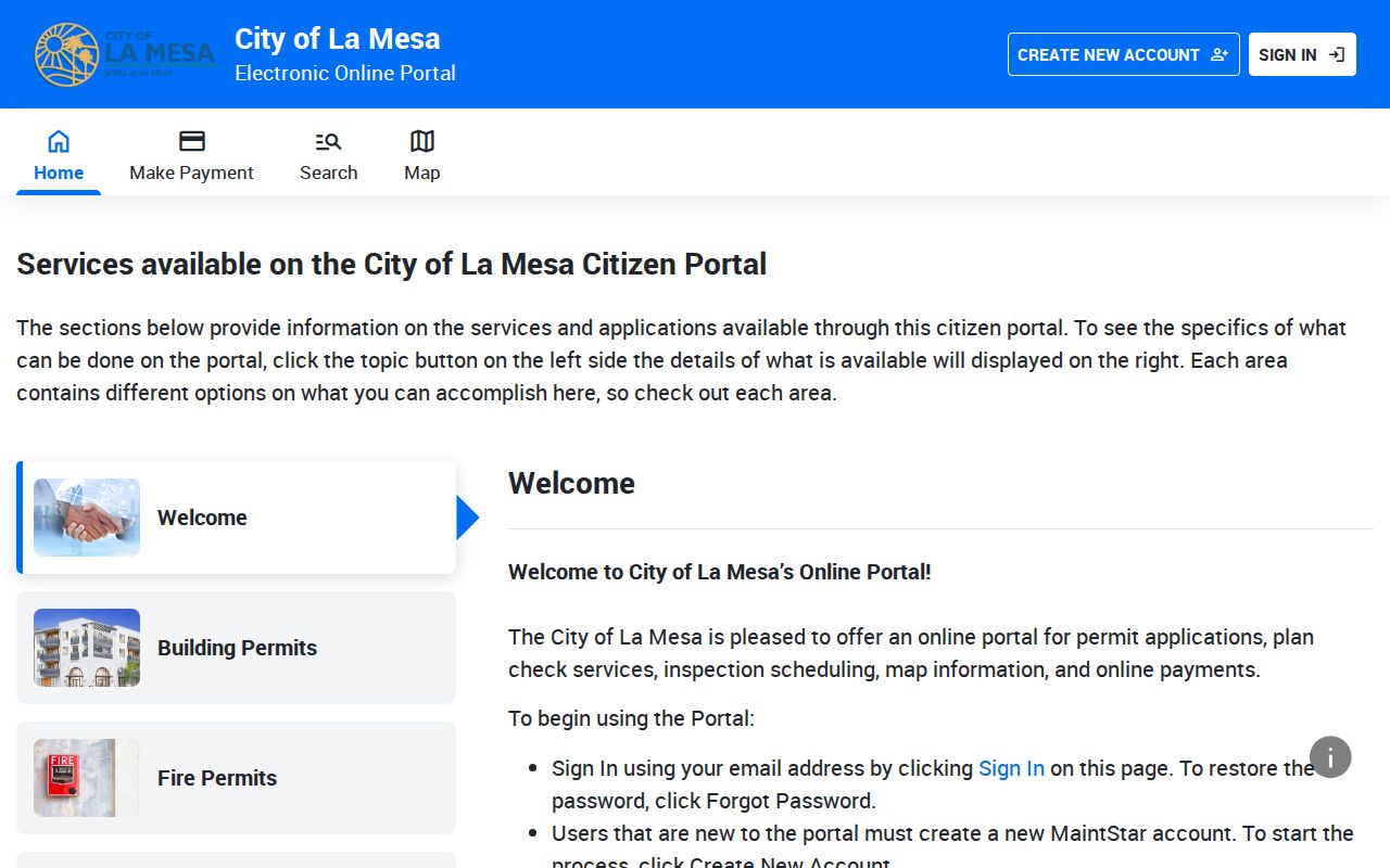
The portal image shows why the street directory record chain needs a fallback. The city’s right-of-way permit page supplies a separate address-evidence path for work in the public way.
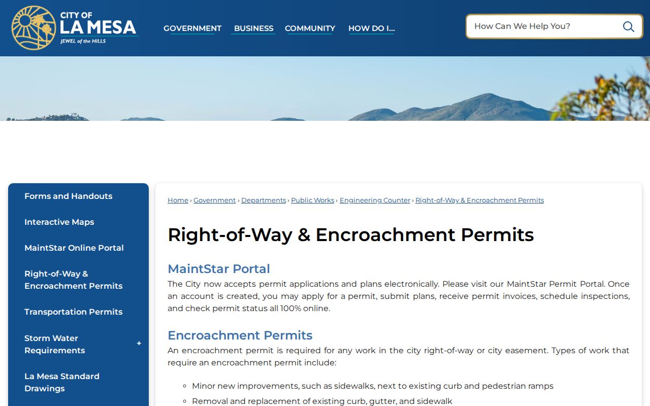
Physical work dates can anchor a house history, but ownership still comes from the deed and occupancy remains a separate question.
Read La Mesa Reverse Directories
The later Polk format gives the historical street directory its two-way search. Green pages in the Householders’ Directory and Street and Avenue Guide place numbers in sequence, show intersecting streets, list names and phones, and use owner or occupant marks. Alphabetical pages then add spouses, occupations, employers, and household context. Start with the street sequence when the address is known, then move to the surname pages.
La Mesa History Center holdings state city-directory coverage from 1887-1973, while San Diego Public Library holds San Diego-area city directories from 1886-2021 onsite. The local range is aggregate rather than a verified annual run. Names may be abbreviated, initials may stand in for given names, and a woman may appear under a spouse-based convention. Keep the edition and page beside each transcription.
Historical entries are useful to a past-residents search because they distinguish the named householder from a place. They can also show a business on a street when no modern public directory does. The full collection and entry-reading method belongs on the La Mesa city directory collections page.
La Mesa Street History: Railroad to Nebo
A La Mesa address can change text without a house changing place. The Roehr House landmark material traces one property through Railroad Avenue, 334 S Nebo, 332 S Nebo, and 4646 Nebo. It also follows Frederick Roehr, Andrew Lazarus, George and Johanna Moore, Alvin Egrmayer, Carl and Jessica Cooper, and later household references through 2019. The sequence is a local warning against searching an old number as if it were a current one.
Use a landmark nomination, directory street guide, parcel map, and deed legal description together. Lookout Avenue became La Mesa Boulevard in the 1940s, another reason for a name-variant pass. When a street directory result disappears, test the former name, an intersection, and the APN before deciding that the household moved.
Address continuity is especially useful for family history. A reverse directory may show a householder, while a deed shows the land role. The two lines become stronger when their years overlap without being mistaken for the same kind of evidence.
La Mesa ZIP Labels on a Street
ZIP labels help sort mail, not prove city jurisdiction. 91941 covers a southern and eastern postal area with many in-city addresses and some locations beyond the city. 91942 covers central and northern La Mesa, including City Hall. 91943 is a La Mesa P.O.-box ZIP. 91944 appears on legacy or administrative forms, and current ordinary residential status was not independently confirmed.
Use the USPS ZIP lookup for an exact address, then compare the result with the city’s Street Address Listing and the Census incorporated-place boundary. A ZIP-wide resident list does not exist in the verified assessor roll. The roll offers APN, Address, and Street Name modes, not ZIP filtering.
That mismatch affects permits, code records, and old directories. Search the postal form and the incorporated-city form when a street sits near the edge of La Mesa, then use the county APN for property records.
La Mesa Street Directory Limits
A street directory cannot provide a complete household roster. The assessor roll suppresses owner names online. Deeds name recorded parties, not all residents. Reverse directories omit people, lag moves, and can preserve a former address. City permits name filed applicants or agents, not every person who used a building. California voter status is a self-check, and voter-file access is restricted to approved purposes.
Privacy boundary. Use by-address records for lawful family, civic, property, or personal-safety research. Do not use a La Mesa street directory to stalk, harass, intimidate, or create unwanted contact. Protected addresses, household-member details, utility customers, delivery records, and motor-vehicle data are not a public street list.
For a single person, compare a name, date, address, and record role across two official sources. For the block around one parcel, use the adjacent-parcel method on the La Mesa neighbors page. Stop when the next step would require private data or an inference the record cannot support.